
Chile: Chilean Puna - Puna Chilena - 20 photos - 20 fotos - Music: Inti Illimani (Chile) - Huajra - Quena (Reed flute) music - Andean folk - Folklore Andino
Posted by Ricardo Marcenaro | Posted in Chile: Chilean Puna - 20 photos - 20 fotos - Music: Inti Illimani (Chile) - Huajra - Quena (Reed flute) music - Andean folk , Music: Inti Illimani - Huajra - Quena (Reed flute) Folk. Chile: Puna photos | Posted on 4:51

Inti Illimani

Here are pics, mostly along Highway 5 ("Ruta 5"), between La Serena and Antofagasta. The driest section (where, in some cases, no rain has ever been measured) was around 100 miles south of Antofagasta (and somewhat inland as coastal mountains keep fog out of that area). Areas further south (closer to La Serena) receive a few inches of rain in an average year. Along the coast, there were some wildflowers due mostly to moisture from coastal fog.
First...views from the very driest part of the desert, where soils (and jagged rocks, not shaped by water) are supposedly similar to those on Mars (about 100 miles south of Antofagasta, along Highway 5). In a few areas, there is not even evidence of water carving the terrain (such as canyons).

Closeup of rocks and soil in a slightly different location...

A view to the east of Volcán Llullaillaco (around 22,000 feet above sea level). Note that there is some dust to restrict the visibility.

A bus stop along Highway 5 in the driest section...

A little "marine layer" cape of stratus and fog a bit north of the driest spot, near Antofagasta (where stratus and fog are common, despite only about 1/10 inch of rain per year).

Roadside shrines were quite common (and often quite elaborate) along highways in Chile, especially in the north (they're highly visible). These mark where people died (probably of a traffic accident). This is about 200 miles south of Antofagasta, where it's still mostly too dry for plants, but at least there is evidence of past water in the terrain...

Broader view...

A little further south (between Chañaral and Caldera), Highway 5 follows the coast.


Note the marine layer stratus (just north of Caldera)...
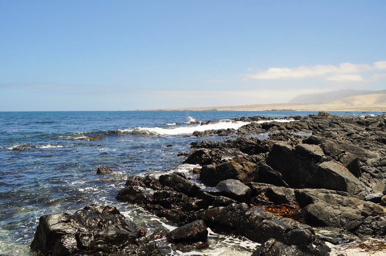
A couple of Band-tailed Gulls along the coast...

And...because of the coastal fog, there are a few wildflowers here! These are Cisanthe/Calandrinia longiscapa (it's rare enough not to have a common name)...


A mystery plant with very succulent leaves at the same location...


Further south, trunked cacti became common (these are Eulychnia acida, south of Vallenar)...
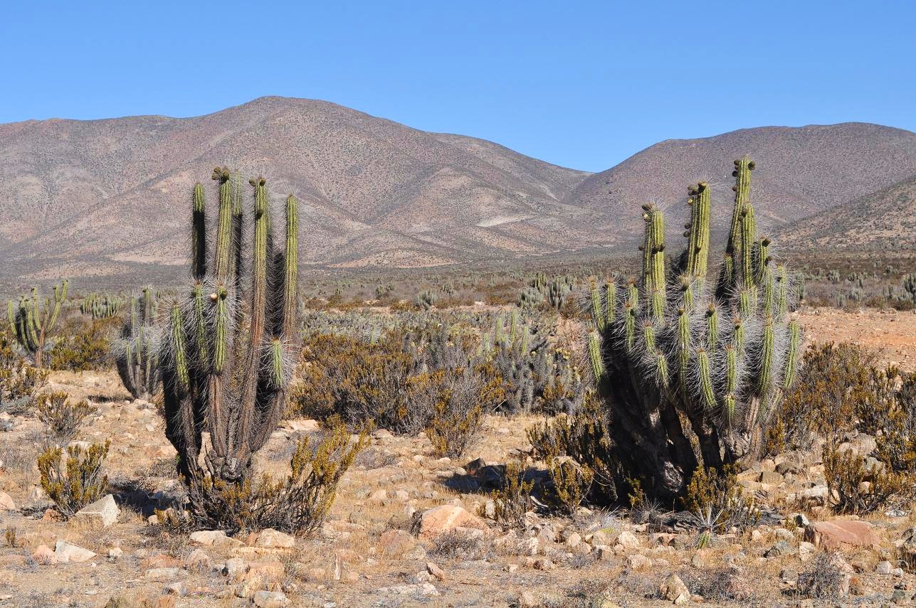

A mystery cactus (might be tunilla (Miqueliopuntia miquelii)) growing among the Eulychnia acida...

And finally, "Ruta 5" kilometer marker signs were frequently vandalized (the R was changed to a P, though some of the KM signs had just "R-5"). This is just north of Vallenar at dusk...

All of the above pictures on this page were taken in November 2009 by Brandt Maxwell.
Chile: Chilean Puna - Puna Chilena - 20 photos - 20 fotos - Music: Inti
Illimani (Chile) - Huajra - Quena (Reed flute) music - Andean folk -
Folklore Andino
Ricardo M Marcenaro - Facebook
Operative blogs of The Solitary Dog:
solitary dog sculptor:
http://byricardomarcenaro.blogspot.com
Solitary Dog Sculptor I:
http://byricardomarcenaroi.blogspot.com
Para:
comunicarse conmigo,
enviar materiales para publicar,
propuestas:
marcenaroescultor@gmail.com
For:
contact me,
submit materials for publication,
proposals:
marcenaroescultor@gmail.com
Diario La Nación
Argentina
Cuenta Comentarista en el Foro:
Capiscum
My blogs are an open house to all cultures, religions and countries. Be a follower if you like it, with this action you are building a new culture of tolerance, open mind and heart for peace, love and human respect.
Thanks :)
Mis blogs son una casa abierta a todas las culturas, religiones y países. Se un seguidor si quieres, con esta acción usted está construyendo una nueva cultura de la tolerancia, la mente y el corazón abiertos para la paz, el amor y el respeto humano.
Gracias :)

Comments (0)
Publicar un comentario