
NASA: Siberi 2012: Progress along the Embenchime - Fighting the Embenchime - On the Banks of the Embenchime - Long Day in the Larch - From the Earth Observatory Blog
Posted by Ricardo Marcenaro | Posted in NASA: Siberi 2012: Progress along the Embenchime - Fighting the Embenchime - On the Banks of the Embenchime - Long Day in the Larch - From the Earth Observatory Blog | Posted on 20:25
Siberia 2012: Progress along the Embenchime
July 14th, 2012 by Joanne Howl
Embenchime River 66° 2 min N 97° 49 min E
11:30 p.m. Siberia 11:30 a.m. EDT
71°F High 44°F low Sunny
Dr. Ranson reports:
We fought the river again today, but in the end, we have been successful. We’re now tucked away in camps – the one we wanted to reach yesterday. Again, our trip was a long struggle against the shallows and small rapids. Each spot is about 50 to 100 feet long, and filled with rocks. To get around them, we have to get out and pull the boat. Slava calls these rocky ripples “dragon’s teeth”, because they are sharp and will eat our boats if we let them. We’ve been careful, but the bottom of our boats have suffered, anyway.
We left camp late today, about 2:30 p.m. We got up early, but there was work to do, such as repairing the boats from yesterday’s rough river ride. We spent over 6 ½ hours on the Embenchime today, to go about 17 kilometers straight-line down river. Because of all twists and turns, we actually travelled 20 or 25 kilometers (12 to 15 miles). But still, that’s something like 4 or 5 kilometers an hour – that’s just two or three miles an hour. We could walk faster than that! But we have too much gear to carry on our backs, so that’s not an option. We’ll stick to the boats, and hope for deeper channels.

We were fortunate in our campground last night. This morning, Slava walked over the hill, and discovered an area where fire had burned about 60 years ago. This morning Slava and Sergei worked that area, collecting samples for the fire return studies. He was quite pleased, and gathered a good deal of useful samples.
Collecting data for fire return studies is a bit more invasive than our tree measurements. To learn a tree’s history, unfortunately, the tree must be sacrificed. We need to collect a disc all the way through the truck, so that we can count the age, look at growth rings, as well as to see when fires singed the bark. We get a tremendous amount of information out of each sample, but Slava makes careful selections, because we don’t want to be cutting down the forest. We sample very carefully and selectively. When we measure trees, we take measurements of every tree above 5 cm in diameter in our study plot. When Slava takes fire return samples, however, he will take only one or two carefully selected trees in the forest.
In order to gather his samples, Slava begins by locating an area that appears to have been affected by fire in the past. He likes to find trees that have a burn scar visible on the trunk. That way, once the sample has been collected, we have a positive date for one fire. He can then carefully analyze the growth pattern, and if there are any other fire scars inside, he can date the years between the fires.
Once a tree is scarred by fire, it keeps that mark for life. As it ages, the trunk will grow over the wound, and it no longer will be visible on the living tree. But the tree carries that mark, inside, for life. That’s what Slava is looking for – the internal scars to compare against external scars.
When we look at a forest, we can often tell if a fire has passed by in recent years. We can’t tell the distant past – that’s why we need the fire return samples. But we can tell if fire has scorched the trees in more recent times. The biggest clue is when we see a stand of scattered old trees that are dead or dying, surrounded by a thick growth of younger larch, all of the same age. Because fire damages or kills standing at the time of the fire, as well as provides great conditions for larch regeneration, a few years after a fire you get this pattern – a few sad old trees, surrounded by vigorous new growth.
We actually are seeing a lot of these spots along the river – areas with lots of big trees surrounded by heavy larch regeneration. So this area definitely has burned in years passed, but not very recently. The new trees look young and small, but it takes a long time for them to grow in this area, with the cold and harsh winters. Near our campsite, the new trees look pretty small, but we are estimating they are at least 60 years old. As the climate warms, however, we expect to see the regeneration grow more quickly. It’s been warming in this area for the last several decades, so we have to be a bit cautious in our age estimations. We’ll confirm the age by counting growth rings on the samples Slava has collected.
 When a tree dies in northern Siberia, it doesn’t decompose like you
would expect. We’re used to the southern climates, where decomposition
is relatively rapid. But it’s cold and dry here, and dead trees stand
for a very long time. We have written papers on fire return, not on this
very spot, but in similar areas in Siberia, where we studies forests
where the trees that had died in the Little Ice Age – back in the 1500’s
– were still standing. Those trees are still here, 700 years or so
later, with very little decomposition. Should the climate warm, we
would also expect the rate of decomposition to pick up quickly. The
old, dead trees of Siberia are holding a lot of carbon in their trunks.
When they begin to decompose, that carbon will be released – one of the
many reasons that the boreal forests, which are now considered carbon
sinks that help slow climate change – may become carbon sources in a
warming world.
When a tree dies in northern Siberia, it doesn’t decompose like you
would expect. We’re used to the southern climates, where decomposition
is relatively rapid. But it’s cold and dry here, and dead trees stand
for a very long time. We have written papers on fire return, not on this
very spot, but in similar areas in Siberia, where we studies forests
where the trees that had died in the Little Ice Age – back in the 1500’s
– were still standing. Those trees are still here, 700 years or so
later, with very little decomposition. Should the climate warm, we
would also expect the rate of decomposition to pick up quickly. The
old, dead trees of Siberia are holding a lot of carbon in their trunks.
When they begin to decompose, that carbon will be released – one of the
many reasons that the boreal forests, which are now considered carbon
sinks that help slow climate change – may become carbon sources in a
warming world.
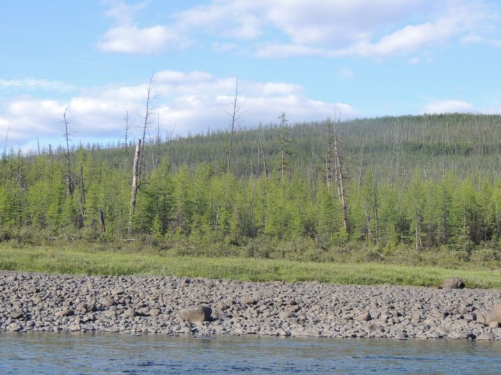
We also have studied the line between the forest and the tundra. Trees can only survive under certain conditions, and in the far north, and at high elevations, the conditions become too harsh to support even the tough Larch trees. That’s where the forest – the taiga – gives way to the scrubby grasslands, which is called the tundra. We call this transition zone the taiga-tundra ecotone. We are interested in finding where this line lies today, and how it has changed from the past. We also are very interested in how it is changing.
Because dead trees stand so long here, we can find the tree line at the time of the Little Ice Age pretty easily, by looking at where those long-dead, or “fossil trees” are located. And we can compare that line to the very easily located modern taiga-tundra ecotone.
What we are seeing – and are able to measure and document – is that the forests are now surpassing the historical extent of those ancient forests. Trees are extending further north and at higher elevations that ever recorded before. That’s not just happening here, but also in the Sayani and the Altai mountains – and has been documented in many other places in the boreal forests, as well. The prediction is that as the climate warms, forests will continue to push upslope. This has been clearly happening for the last several decades. Scientists will continue to make these measurements, to track what is happening now, in the decades to come.
As for tomorrow, we plan to stay put and measure. We are close to a line of GLAS plots, and we’ll work those plots. However, it looks like the GLAS line heads up a river and up a steep hillside. That’s not so good. It’s hard to get to the plots, sure, but that’s not the real problem. The big problem is that, because GLAS was created to measure ice, not vegetation, that the GLAS data has some real limitations. It’s not that great for vegetation to begin with, but it’s particularly poor in steep slopes. We’ll get the data, however, so maybe we can learn something that will help us better use GLAS. But we really, really need an instrument designed for vegetation. The boreal forests are really important and we need a tool designed for measuring vegetation. We’re working on the problem – we’re hopeful that the G-LiHT system will prove useful. But our need is very great.
For now, we’ll spend tomorrow making measurements for the old (GLAS) and the new (G-LiHT) instruments, and we’ll look for potential fire return study samples. And we’ll also try to figure out how to get to Tura on time. It’s a balancing act – we have limited time, and we have need for time to measure, and more time than planned to travel.
We also need some time to repair our boats, and to dry out our generator and other gear that got soaked in the boats, because of all the leaks. It’s ironic – now that the data terminal works just fine, we lose our ability to connect because of a wet generator! It will dry, and will be fine. It’s just a communications delay, not a disaster.
 At dinner tonight, talked about the river – its virtues and its
evils. The Embenchime is a hard river. It makes us work in order to
gain headway. The rapids, the shallow water at every turn, and so very
many turns – this is so difficult. We want to go fast, but the
Embenchime holds us back.
At dinner tonight, talked about the river – its virtues and its
evils. The Embenchime is a hard river. It makes us work in order to
gain headway. The rapids, the shallow water at every turn, and so very
many turns – this is so difficult. We want to go fast, but the
Embenchime holds us back.
On the other hand, the Embenchime is incredibly scenic, and very beautiful. Today was sunny, with clean blue skies decorated with white clouds. A few mares tails were wispy in the sky, with high cirrus clouds scattered about. It was warm today, but the waters of the river were cool and refreshing At times, the Embenchime is kind and pleasant. But at every turn, she is also so very harsh.
We’re hoping that we will see more virtues and less evil as we head further down river. There will be some tributaries joining soon, and we hope that will mean more water and an easier ride. But the river will, no doubt, continue be what it is – both beautiful and difficult.
11:30 p.m. Siberia 11:30 a.m. EDT
71°F High 44°F low Sunny
Dr. Ranson reports:
We fought the river again today, but in the end, we have been successful. We’re now tucked away in camps – the one we wanted to reach yesterday. Again, our trip was a long struggle against the shallows and small rapids. Each spot is about 50 to 100 feet long, and filled with rocks. To get around them, we have to get out and pull the boat. Slava calls these rocky ripples “dragon’s teeth”, because they are sharp and will eat our boats if we let them. We’ve been careful, but the bottom of our boats have suffered, anyway.
We left camp late today, about 2:30 p.m. We got up early, but there was work to do, such as repairing the boats from yesterday’s rough river ride. We spent over 6 ½ hours on the Embenchime today, to go about 17 kilometers straight-line down river. Because of all twists and turns, we actually travelled 20 or 25 kilometers (12 to 15 miles). But still, that’s something like 4 or 5 kilometers an hour – that’s just two or three miles an hour. We could walk faster than that! But we have too much gear to carry on our backs, so that’s not an option. We’ll stick to the boats, and hope for deeper channels.
At
every turn in the Embenchime, the water becomes too shallow for boats
to float, so the scientists must get out and drag the boats over the
rapids. In some of the shallows, sharp rocks form a formidable
challenge. These rapids have become known as “dragon’s teeth”, for their
ability to bite the bottom of the boats, and cause damage.
We were fortunate in our campground last night. This morning, Slava walked over the hill, and discovered an area where fire had burned about 60 years ago. This morning Slava and Sergei worked that area, collecting samples for the fire return studies. He was quite pleased, and gathered a good deal of useful samples.
Collecting data for fire return studies is a bit more invasive than our tree measurements. To learn a tree’s history, unfortunately, the tree must be sacrificed. We need to collect a disc all the way through the truck, so that we can count the age, look at growth rings, as well as to see when fires singed the bark. We get a tremendous amount of information out of each sample, but Slava makes careful selections, because we don’t want to be cutting down the forest. We sample very carefully and selectively. When we measure trees, we take measurements of every tree above 5 cm in diameter in our study plot. When Slava takes fire return samples, however, he will take only one or two carefully selected trees in the forest.
In order to gather his samples, Slava begins by locating an area that appears to have been affected by fire in the past. He likes to find trees that have a burn scar visible on the trunk. That way, once the sample has been collected, we have a positive date for one fire. He can then carefully analyze the growth pattern, and if there are any other fire scars inside, he can date the years between the fires.
Once a tree is scarred by fire, it keeps that mark for life. As it ages, the trunk will grow over the wound, and it no longer will be visible on the living tree. But the tree carries that mark, inside, for life. That’s what Slava is looking for – the internal scars to compare against external scars.
When we look at a forest, we can often tell if a fire has passed by in recent years. We can’t tell the distant past – that’s why we need the fire return samples. But we can tell if fire has scorched the trees in more recent times. The biggest clue is when we see a stand of scattered old trees that are dead or dying, surrounded by a thick growth of younger larch, all of the same age. Because fire damages or kills standing at the time of the fire, as well as provides great conditions for larch regeneration, a few years after a fire you get this pattern – a few sad old trees, surrounded by vigorous new growth.
We actually are seeing a lot of these spots along the river – areas with lots of big trees surrounded by heavy larch regeneration. So this area definitely has burned in years passed, but not very recently. The new trees look young and small, but it takes a long time for them to grow in this area, with the cold and harsh winters. Near our campsite, the new trees look pretty small, but we are estimating they are at least 60 years old. As the climate warms, however, we expect to see the regeneration grow more quickly. It’s been warming in this area for the last several decades, so we have to be a bit cautious in our age estimations. We’ll confirm the age by counting growth rings on the samples Slava has collected.
Fires
are a part of the larch forest ecosystem. Although there are no fires
at this time, there is evidence of widespread fire in the past. A fire
burned in this location about 60 years ago, leaving scattered large
trees dead and dying. A strong surge in new larch growth followed. The
post-fire forest is characterized by a same-age stand of young larch,
punctuated by scattered old, dead trees.
We also have studied the line between the forest and the tundra. Trees can only survive under certain conditions, and in the far north, and at high elevations, the conditions become too harsh to support even the tough Larch trees. That’s where the forest – the taiga – gives way to the scrubby grasslands, which is called the tundra. We call this transition zone the taiga-tundra ecotone. We are interested in finding where this line lies today, and how it has changed from the past. We also are very interested in how it is changing.
Because dead trees stand so long here, we can find the tree line at the time of the Little Ice Age pretty easily, by looking at where those long-dead, or “fossil trees” are located. And we can compare that line to the very easily located modern taiga-tundra ecotone.
What we are seeing – and are able to measure and document – is that the forests are now surpassing the historical extent of those ancient forests. Trees are extending further north and at higher elevations that ever recorded before. That’s not just happening here, but also in the Sayani and the Altai mountains – and has been documented in many other places in the boreal forests, as well. The prediction is that as the climate warms, forests will continue to push upslope. This has been clearly happening for the last several decades. Scientists will continue to make these measurements, to track what is happening now, in the decades to come.
As for tomorrow, we plan to stay put and measure. We are close to a line of GLAS plots, and we’ll work those plots. However, it looks like the GLAS line heads up a river and up a steep hillside. That’s not so good. It’s hard to get to the plots, sure, but that’s not the real problem. The big problem is that, because GLAS was created to measure ice, not vegetation, that the GLAS data has some real limitations. It’s not that great for vegetation to begin with, but it’s particularly poor in steep slopes. We’ll get the data, however, so maybe we can learn something that will help us better use GLAS. But we really, really need an instrument designed for vegetation. The boreal forests are really important and we need a tool designed for measuring vegetation. We’re working on the problem – we’re hopeful that the G-LiHT system will prove useful. But our need is very great.
For now, we’ll spend tomorrow making measurements for the old (GLAS) and the new (G-LiHT) instruments, and we’ll look for potential fire return study samples. And we’ll also try to figure out how to get to Tura on time. It’s a balancing act – we have limited time, and we have need for time to measure, and more time than planned to travel.
We also need some time to repair our boats, and to dry out our generator and other gear that got soaked in the boats, because of all the leaks. It’s ironic – now that the data terminal works just fine, we lose our ability to connect because of a wet generator! It will dry, and will be fine. It’s just a communications delay, not a disaster.
Connectivity
is prized here – and not easy to accomplish. The data terminal was
difficult at first, making connection to the internet impossible or
difficult. Today, the generator was soaked by a leaking boat. While it
dries, the computer cannot be charged so connectivity is once again
impossible. When the internet is up, the scientists will go to great
lengths to use it for a few minutes. Here Dr. Guoqing Sun is using the
internet. Shading from the sun is required in order to be able to read
the screen.
On the other hand, the Embenchime is incredibly scenic, and very beautiful. Today was sunny, with clean blue skies decorated with white clouds. A few mares tails were wispy in the sky, with high cirrus clouds scattered about. It was warm today, but the waters of the river were cool and refreshing At times, the Embenchime is kind and pleasant. But at every turn, she is also so very harsh.
We’re hoping that we will see more virtues and less evil as we head further down river. There will be some tributaries joining soon, and we hope that will mean more water and an easier ride. But the river will, no doubt, continue be what it is – both beautiful and difficult.
Siberia 2012: Fighting the Embenchime
July 13th, 2012 by Joanne Howl
Embenchime River 66.15 N 97.57 E
73°F High 40°F Low Periods of rain and strong wind
11:50 p.m. Siberia 11:50 a.m. Eastern Daylight Time
From Dr. Ranson:
It is near midnight, and we just got off the river. I helped get us situated and safe, but then left the others so I could check in. Dinner is cooking, and it smells fantastic. We don’t always eat regular meals here – but when we do get our supper, it is very welcome.
I realized just a few minutes ago that today is Friday the 13th. In America it’s considered an unlucky date. Many people might say, probably half-jokingly, that it is no time to travel or take risks. Well, although I’m not superstitious, I have to admit that this was not the luckiest day to run the river. No one is hurt, and there were no tragedies. But we struggled with this river today.
The day started beautifully. A bright, warm morning after a crisp, chill night. We ate fried pike and bread for breakfast, then broke camp. We took down the tents, packed all the gear, and then loaded our three boats. We don’t have excess gear – but you can’t say that we pack lightly.
Our goal for today was to reach the next camp, 39 kilometers down river. That’s nearly 25 miles – a good day’s trip. However, that was 39 kilometers “as the crow flies”. Crows have the common sense to fly in a straight line – but the Embenchime apparently has no sense. It twists and turns all over the place. Following the river, we had to travel around 60 km (37 mi) or more to reach the next camp. We didn’t quite make it. We’re camping riverside at least 15 km short of plan.
 The long distance didn’t thwart us – it was the river depth. The
Embenchime is about 150 feet wide, and supposed to run 2-3 feet deep.
However, the water level is very low. In many spots the rocks were just
a few inches under water. Sometimes we could motor along, but often –
way too often – we had to get out and pull our boats over the rocky
shallows. When we get our weight out of the boat, the boat is lighter
and floats higher. With some luck and a lot of work, we were able to
pass all of the riffles.
The long distance didn’t thwart us – it was the river depth. The
Embenchime is about 150 feet wide, and supposed to run 2-3 feet deep.
However, the water level is very low. In many spots the rocks were just
a few inches under water. Sometimes we could motor along, but often –
way too often – we had to get out and pull our boats over the rocky
shallows. When we get our weight out of the boat, the boat is lighter
and floats higher. With some luck and a lot of work, we were able to
pass all of the riffles.
When we found deeper water, I thought it would be relatively restful. But not today. When we are under power, Slava and I sit in the lead boat, with all the rest of the boats tied together in a line. We are like the mother duck, with our two ducklings following behind, one after another in a nice little row. Unlike a mother duck, however, the lead boat is not very mobile. The motor provides power, but under such weight it isn’t very effective at steering. So the guy in the front of the boat – that’s me – gets to act like a human rudder, and steer the boat. In deep water, sometimes this is just a pleasant ride with a little push here and there. But on the shallow Embenchime, it was constant work – paddle left, paddle right, we have to hit that deep channel just right, and we have to miss those rocks! It was quite a workout.
Not that I’m complaining – it’s just how it goes. Slava provided all the steering the motor had in it, and we needed him to run that motor. We all have our own work to do. All I can say is… I’m sure I will sleep soundly tonight.
I’m definitely in a carb and calorie burning mode right now. We’re eating high protein fish dinners, with just a few carbs and a lot of exercise. The Embenchime River Diet sure packs a punch! That reminds me, though – Ross was back in the third boat today. No frantic paddling for him. After today, I think I have a leg up on our weight-loss challenge!
After we’d worked hard to free ourselves of the shallows, and were finally motoring forward relatively well, Slava and I noticed something disturbing. Our boat was taking on water. We weren’t sinking, but we sure had a leak, no doubt from dragging the boat over the sharp rocks in the shallows. The lead boat carries gear that should stay as dry as possible, so we couldn’t keep going. We pulled over, pulled the motor off our boat, and switched it to a sounder boat. Our leaky boat became a cargo boat (most of the cargo can stand getting a bit wet) and after all of that, we were underway once more.
Unfortunately, it wasn’t too long before we noticed water in this boat, too. It had also been damaged, and now was leaking. Once more, we had to switch boats, move the motor, move the cargo, and repack. We couldn’t take time to make repairs – we were too far behind schedule. That meant the cargo, as well as Ross, Pasha, Guoqing and Sergei, would have to ride wet today.
Luckily, we finally found a good spot to make camp tonight. It’s a gravel bar on the river. The stones are smaller in diameter her than our first camp, so I think it will be more comfortable sleeping. The light is very soft right now. The sun went down at 11:20 p.m. It’s after midnight now, and I can still see the sun shining on the hills to the east. Here, in camp, we are in dusky shade. I don’t think it gets darker than this… and it is still light enough that I could read a newspaper. It’s the land of the almost-midnight sun.
Usually the days on the river are the days we can rest and regroup. It’s a time to observe the forest biomes on the sides of the river. And a day of contemplation, too – a time to think about what we’ve seen, what it all might mean. Today, however, there was not much time for thinking, and not much time for observation.
In the quieter times, I was able to notice my surroundings. For example, I found myself noting that my horde of mosquito friends was fairly thin. Don’t get me wrong – there are plenty of mosquitoes here, for sure. But not the overwhelming thousands clinging to everything that I’ve come to expect in this region.
There continues to be more mammal life on this river than we’ve seen elsewhere, in years past. Today we saw a cow and a calf peacefully sharing a long drink from the river. An agitated bull moose pranced back and forth on the bank as we passed by – as if he didn’t know whether to hold his ground or run off into the woods. While he was showing off, a beautiful eagle flew overhead. It was very big, with a solid white tail. I understand that there are several types of eagle that live in northern Siberia, including the White-tailed Eagle. I suspect that is what this was, because it had a very huge wingspan, and the White-tailed Eagle not only has a white tail, but it is said to be the largest eagle in the world.
The forests are still all larch. We see some areas that have been burned in the past and have lots of young trees, but no recent fires. There are a few trees leaning here and there, and a few banks have collapsed. These things happen when permafrost – the permanently frozen soil that lies a meter or so under the groundcover in Siberia – thaws. We’ve seen a few small signs of random thawing, but nothing wide scale.
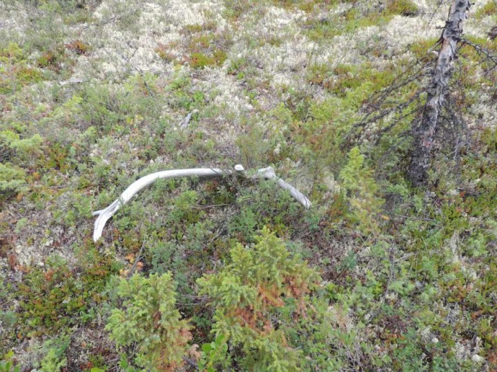
Yesterday I came across a few juniper plants near camp. I picked a branch, and put it in my pocket. Apparently some of the locals in Russia believe that burning the juniper and letting the smoke go through your vehicle gives safe travel. We didn’t burn any this morning, but maybe we should have tried a little Russian superstition to be a counter to the American Friday the 13th superstition? Maybe we can try tomorrow morning.
 Ah, I was called to supper, and I had to pause. I wasn’t about to
miss out on this meal – it’s been a very, very long time since lunch.
And will be a long time until breakfast. In honor of the hard day’s
work, we had canned beef with spaghetti noodles and tomato sauce. Cow
and carbs. It was quite good, and I think we all feel better now.
Ah, I was called to supper, and I had to pause. I wasn’t about to
miss out on this meal – it’s been a very, very long time since lunch.
And will be a long time until breakfast. In honor of the hard day’s
work, we had canned beef with spaghetti noodles and tomato sauce. Cow
and carbs. It was quite good, and I think we all feel better now.
It’s now after 1:00 a.m., July 14, here. We’ve finished most of our work, and everyone has a few free minutes. Ross has gone to his tent. Guoqing is taking photos, and Slava is taking photos. It’s a spectacular night for pictures. There is a wispy fog rising from the river, and the light is dim. As the fog winds around the tents and trees, it appears quite striking. I am relaxing and sharing today’s story, which is still work, but not too painful. Sergei and Pasha – well, I guess they aren’t relaxing. They are repairing the holes in the boats.
There is still work to do before I sleep, so I will sign off for now. The plan tomorrow is to get up, repair the boats, then get downriver to the camp we’d planned to reach today. If we get in early, we can start our measurements. That is our goal.
At dinner we talked about the river – the challenges this river has given us today were amazing. Slava says it took us 10 hours to travel 40 kilometers. We need to speed it up. We have about 440 kilometers left to reach Tura. At this rate, we might get there by Christmas! The river should deepen tomorrow, and even more as we near the Kochechum. It’s usually not so difficult. However, this has been a very dry spring, following a very dry winter. There has been almost no rain and little snow. Without snowmelt and without new rain, the rivers can’t help but run low.
Did I mention that we fought a strong storm that came up today? It poured rain for a time, but no lightning, so we were safe on the river. But the wind blew very, very hard from the south. It overpowered our motors and actually pushed us upriver! I think that was the worst moment of the entire trip. After struggling so hard to get downstream, to lose ground so quickly was frustrating. The storm passed, and we made it to this camp, all in one piece. The Embenchine is relatively small, but she has gained our respect.
73°F High 40°F Low Periods of rain and strong wind
11:50 p.m. Siberia 11:50 a.m. Eastern Daylight Time
From Dr. Ranson:
It is near midnight, and we just got off the river. I helped get us situated and safe, but then left the others so I could check in. Dinner is cooking, and it smells fantastic. We don’t always eat regular meals here – but when we do get our supper, it is very welcome.
I realized just a few minutes ago that today is Friday the 13th. In America it’s considered an unlucky date. Many people might say, probably half-jokingly, that it is no time to travel or take risks. Well, although I’m not superstitious, I have to admit that this was not the luckiest day to run the river. No one is hurt, and there were no tragedies. But we struggled with this river today.
The day started beautifully. A bright, warm morning after a crisp, chill night. We ate fried pike and bread for breakfast, then broke camp. We took down the tents, packed all the gear, and then loaded our three boats. We don’t have excess gear – but you can’t say that we pack lightly.
Our goal for today was to reach the next camp, 39 kilometers down river. That’s nearly 25 miles – a good day’s trip. However, that was 39 kilometers “as the crow flies”. Crows have the common sense to fly in a straight line – but the Embenchime apparently has no sense. It twists and turns all over the place. Following the river, we had to travel around 60 km (37 mi) or more to reach the next camp. We didn’t quite make it. We’re camping riverside at least 15 km short of plan.
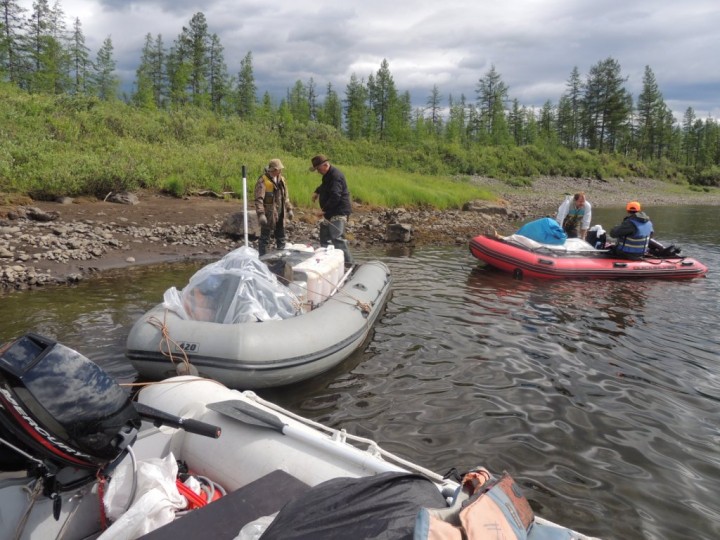
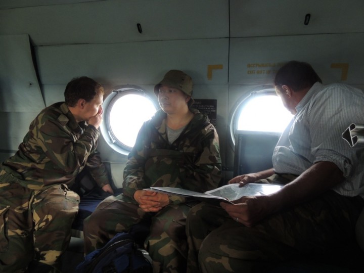
The
convoy of boats which carries the scientists down river. The boats
travel tied together, one after another in a line. The lead boat is
motorized. The second carries the gasoline, cargo and a passenger or
two, and the rear boat carries cargo and passengers. Ross and Guoquing
board the rear boat, while Slava and Pasha work on the ropes.
When we found deeper water, I thought it would be relatively restful. But not today. When we are under power, Slava and I sit in the lead boat, with all the rest of the boats tied together in a line. We are like the mother duck, with our two ducklings following behind, one after another in a nice little row. Unlike a mother duck, however, the lead boat is not very mobile. The motor provides power, but under such weight it isn’t very effective at steering. So the guy in the front of the boat – that’s me – gets to act like a human rudder, and steer the boat. In deep water, sometimes this is just a pleasant ride with a little push here and there. But on the shallow Embenchime, it was constant work – paddle left, paddle right, we have to hit that deep channel just right, and we have to miss those rocks! It was quite a workout.
Not that I’m complaining – it’s just how it goes. Slava provided all the steering the motor had in it, and we needed him to run that motor. We all have our own work to do. All I can say is… I’m sure I will sleep soundly tonight.
I’m definitely in a carb and calorie burning mode right now. We’re eating high protein fish dinners, with just a few carbs and a lot of exercise. The Embenchime River Diet sure packs a punch! That reminds me, though – Ross was back in the third boat today. No frantic paddling for him. After today, I think I have a leg up on our weight-loss challenge!
After we’d worked hard to free ourselves of the shallows, and were finally motoring forward relatively well, Slava and I noticed something disturbing. Our boat was taking on water. We weren’t sinking, but we sure had a leak, no doubt from dragging the boat over the sharp rocks in the shallows. The lead boat carries gear that should stay as dry as possible, so we couldn’t keep going. We pulled over, pulled the motor off our boat, and switched it to a sounder boat. Our leaky boat became a cargo boat (most of the cargo can stand getting a bit wet) and after all of that, we were underway once more.
Unfortunately, it wasn’t too long before we noticed water in this boat, too. It had also been damaged, and now was leaking. Once more, we had to switch boats, move the motor, move the cargo, and repack. We couldn’t take time to make repairs – we were too far behind schedule. That meant the cargo, as well as Ross, Pasha, Guoqing and Sergei, would have to ride wet today.
Luckily, we finally found a good spot to make camp tonight. It’s a gravel bar on the river. The stones are smaller in diameter her than our first camp, so I think it will be more comfortable sleeping. The light is very soft right now. The sun went down at 11:20 p.m. It’s after midnight now, and I can still see the sun shining on the hills to the east. Here, in camp, we are in dusky shade. I don’t think it gets darker than this… and it is still light enough that I could read a newspaper. It’s the land of the almost-midnight sun.
Usually the days on the river are the days we can rest and regroup. It’s a time to observe the forest biomes on the sides of the river. And a day of contemplation, too – a time to think about what we’ve seen, what it all might mean. Today, however, there was not much time for thinking, and not much time for observation.
In the quieter times, I was able to notice my surroundings. For example, I found myself noting that my horde of mosquito friends was fairly thin. Don’t get me wrong – there are plenty of mosquitoes here, for sure. But not the overwhelming thousands clinging to everything that I’ve come to expect in this region.
There continues to be more mammal life on this river than we’ve seen elsewhere, in years past. Today we saw a cow and a calf peacefully sharing a long drink from the river. An agitated bull moose pranced back and forth on the bank as we passed by – as if he didn’t know whether to hold his ground or run off into the woods. While he was showing off, a beautiful eagle flew overhead. It was very big, with a solid white tail. I understand that there are several types of eagle that live in northern Siberia, including the White-tailed Eagle. I suspect that is what this was, because it had a very huge wingspan, and the White-tailed Eagle not only has a white tail, but it is said to be the largest eagle in the world.
The forests are still all larch. We see some areas that have been burned in the past and have lots of young trees, but no recent fires. There are a few trees leaning here and there, and a few banks have collapsed. These things happen when permafrost – the permanently frozen soil that lies a meter or so under the groundcover in Siberia – thaws. We’ve seen a few small signs of random thawing, but nothing wide scale.
Yesterday I came across a few juniper plants near camp. I picked a branch, and put it in my pocket. Apparently some of the locals in Russia believe that burning the juniper and letting the smoke go through your vehicle gives safe travel. We didn’t burn any this morning, but maybe we should have tried a little Russian superstition to be a counter to the American Friday the 13th superstition? Maybe we can try tomorrow morning.
An
very old antler, probably from an elk, lying in ground cover next to
juniper. It is said in some parts of Siberia that burning juniper, and
sending the smoke through the vehicles, helps make the journey safe.
After the arduous day on the river today, the team may be tempted to try
this ritual before departing on tomorrow’s river journey.
It’s now after 1:00 a.m., July 14, here. We’ve finished most of our work, and everyone has a few free minutes. Ross has gone to his tent. Guoqing is taking photos, and Slava is taking photos. It’s a spectacular night for pictures. There is a wispy fog rising from the river, and the light is dim. As the fog winds around the tents and trees, it appears quite striking. I am relaxing and sharing today’s story, which is still work, but not too painful. Sergei and Pasha – well, I guess they aren’t relaxing. They are repairing the holes in the boats.
There is still work to do before I sleep, so I will sign off for now. The plan tomorrow is to get up, repair the boats, then get downriver to the camp we’d planned to reach today. If we get in early, we can start our measurements. That is our goal.
At dinner we talked about the river – the challenges this river has given us today were amazing. Slava says it took us 10 hours to travel 40 kilometers. We need to speed it up. We have about 440 kilometers left to reach Tura. At this rate, we might get there by Christmas! The river should deepen tomorrow, and even more as we near the Kochechum. It’s usually not so difficult. However, this has been a very dry spring, following a very dry winter. There has been almost no rain and little snow. Without snowmelt and without new rain, the rivers can’t help but run low.
Did I mention that we fought a strong storm that came up today? It poured rain for a time, but no lightning, so we were safe on the river. But the wind blew very, very hard from the south. It overpowered our motors and actually pushed us upriver! I think that was the worst moment of the entire trip. After struggling so hard to get downstream, to lose ground so quickly was frustrating. The storm passed, and we made it to this camp, all in one piece. The Embenchine is relatively small, but she has gained our respect.
Siberia 2012: The Forest Holds Secrets
July 12th, 2012 by Joanne Howl
Embenchime River 66 N 97 E
9:15 a.m. local, 9:15 p.m. EDT
72°F high 54°F low
Dr. Ranson reports:
It’s been been a very physical day, with a lot of walking and a lot of work, but we’re doing great and gathering a lot of high quality data. The weather was perfect for a day in the field. The sun popped in and out of the clouds all day long, but no rain.
Right now I’m finishing up my work day by placing a phone call to our correspondent-from-home, Joanne. At the end of each day, I tell her our day’s story; she edits it, and then posts it in this blog. Tonight I’m sitting on this big rock on the Embenchime beach, with the late evening sun peeking through clouds and beautiful scenery all around. There’s a nice little breeze, so the mosquitoes are leaving me alone – more or less. Just down river, Ross is chopping wood for our campfire. This correspondent duty has its perks.
 It also has its frustrations. We’ve been struggling with the data
terminal. The first day out, it would not work at all, despite the fact
it appeared just fine. It turns out that we failed to have the proper
permissions from Russia to use the data terminal. That got straightened
out, and the terminal started working – for a few hours. Now it is in
and out, and it makes no sense to me why. Hopefully the company we are
renting from can help get it working. Otherwise, I have no ability to
send photos from the field.
It also has its frustrations. We’ve been struggling with the data
terminal. The first day out, it would not work at all, despite the fact
it appeared just fine. It turns out that we failed to have the proper
permissions from Russia to use the data terminal. That got straightened
out, and the terminal started working – for a few hours. Now it is in
and out, and it makes no sense to me why. Hopefully the company we are
renting from can help get it working. Otherwise, I have no ability to
send photos from the field.
Gouqing, Pasha and I made the GLAS footprint measurements today. We worked a single line, heading away from camp. We were able to complete ten plots. Now remember, there are 172 meters between GLAS footprints. We followed the footprint trail, kind of like following a trail of breadcrumbs, deep into the forest. At the end of the day, we found ourselves really far away from camp.
If you are quick with math, you’ve probably already multiplied 172 by 10, then converted the kilometers to miles, and figured out that we were about a mile into the forest. That doesn’t sound so bad. At home, that’s fifteen to twenty minutes. But this is a very different kind of walk. Terrain around here really makes you work for each step. We’d passed through some pretty rough country coming in … GLAS plots are laid out because the satellite passes above the area, not because it’s nice easy hiking trail. We thought we’d avoid some of the rough stuff, so went cross-country. That made it more like a two-mile walk back.
The upland forests are dry and open, and you can make pretty good time on that footing. But then you get into pillow moss and lichens, where it’s so thick and pillow-like underfoot that walking gets really difficult. It’s like walking on a waterbed. It would be great to sleep on that stuff, but when you stand upright, your feet just sink in and you have to work to keep your balance. Then you move into grassier sedges, where there are humps and water-filled holes. Here you must watch carefully and stretch in order to step only on the humps, because the holes are wet and sometimes deep. Then there are the rocky beaches where you have to be careful, because although footing looks secure, the rocks teeter and totter and, if you step on the wrong one, it might roll away with you. And then there are big clumps of willow and alder, which grow so thick and tall, that you have to physically push your way through. And there are grassy banks that hide creeks that must be crossed, and there are hills to climb … well, you get the idea. It’s tough work. Siberia provides a workout not to be found in any gym.
While we were out making our measurements, Slava, Ross and Sergei worked on the boats, getting us ready for a full day of boating down-river tomorrow. We have four rubber boats, and they are all in fine working order.
After building the boats, Sergei and Ross walked upriver, set up new plots near camp, and measured them. They are not GLAS plots. However, when we take the G-LiHT instrument to the field next year, we won’t be measuring only GLAS plots. That instrument will be covering a much wider area, including the camp area where we stayed this year. The new plots that Sergei and Ross set up and measured will be very important for our future work.
 Again, as we worked in the forest, we came across areas that appeared
to have been burned. The regeneration is pretty tall, so these are not
new fires – they happened a long time ago. Right next to the
fire-scarred forests there were forests of similar age that appeared to
be untouched by fire. I kept wondering about that – why would a
wildfire in the middle of the forest stop burning, all of a sudden?
There would be no intervention – no firefighters to appear to quench the
fires. One would think it would just burn until everything was gone.
But they didn’t do that here. Why?
Again, as we worked in the forest, we came across areas that appeared
to have been burned. The regeneration is pretty tall, so these are not
new fires – they happened a long time ago. Right next to the
fire-scarred forests there were forests of similar age that appeared to
be untouched by fire. I kept wondering about that – why would a
wildfire in the middle of the forest stop burning, all of a sudden?
There would be no intervention – no firefighters to appear to quench the
fires. One would think it would just burn until everything was gone.
But they didn’t do that here. Why?
I was contemplating this question as I also tried to concentrate on placing my feet on the rapidly varying understory as we walked along. The ground cover changes rapidly and dramatically. In one area you have wet, sedge-like material. Very close by you have a soft area with blueberries or Betula nana (bog birch or dwarf birch). Then, in just a little bit, you are in an area with very bright understory, and it is so dry that it you can hear it crunch under your boot with each step.
Given this ground cover variation, and the apparent stop-and-start nature of the fire scars, it seems plausible that the fires that ignite in the extremely dry understory could easily be stopped cold when ground cover changes suddenly. Fire would feed on tinder dry, but couldn’t easily burn the bog.
Late in the afternoon Slava and Sergei went sample trees near camp for fire scars. They returned in a little while with 10 samples for the fire return studies. They will take those samples back to the lab to analyze them for fire scars, as well as look at the growth history as told by the tree rings. Besides forest biomass and carbon, which are my primary interests, we also study fire return intervals. In fact, we’ve had a paper published recently on fire return, and one in the process of publication now.
You know, this group of scientists really has a dynamic and symbiotic relationship. We share interests, but we do have our own primary and diverse interests. On an expedition, we gather a tremendous amount of data that allows study of a broad range of questions. We look at biomass and carbon, ecosystem dynamics, tree growth, fire return interval, ground truth for old remote sensing instruments, validation and calibration data for upcoming new instruments. We look for a better understand of the forest structure, and look for data to help create better instruments and forest modeling systems. We work hard to try to get the forest to reveal some of its many secrets. The forest is sometimes stingy, but each expedition unveils another small golden piece of the whole puzzle.
Our plan for tomorrow is to pack up camp in the morning, load our fine watercraft to the hilt, then head down the Embenchime. We have a long way to travel before we get home, and a lot of work to do between there and here. Our goal is to reach the confluence of the Embenchime and the Kochechum by July 20, because we need a full two days to get from that point to Tura. To make that happen, we will have to make some good time tomorrow on the river. By Saturday, we’ll be in the forest, gathering data, once again.
9:15 a.m. local, 9:15 p.m. EDT
72°F high 54°F low
Dr. Ranson reports:
It’s been been a very physical day, with a lot of walking and a lot of work, but we’re doing great and gathering a lot of high quality data. The weather was perfect for a day in the field. The sun popped in and out of the clouds all day long, but no rain.
Right now I’m finishing up my work day by placing a phone call to our correspondent-from-home, Joanne. At the end of each day, I tell her our day’s story; she edits it, and then posts it in this blog. Tonight I’m sitting on this big rock on the Embenchime beach, with the late evening sun peeking through clouds and beautiful scenery all around. There’s a nice little breeze, so the mosquitoes are leaving me alone – more or less. Just down river, Ross is chopping wood for our campfire. This correspondent duty has its perks.
One
of the major duties today was putting the boats together, and testing
them to make sure they are seaworthy. In the morning the team will break
camp, fill the boats, and head downriver. They have many measurements
and observations to make, and many miles to travel. It is time to move
on.
Gouqing, Pasha and I made the GLAS footprint measurements today. We worked a single line, heading away from camp. We were able to complete ten plots. Now remember, there are 172 meters between GLAS footprints. We followed the footprint trail, kind of like following a trail of breadcrumbs, deep into the forest. At the end of the day, we found ourselves really far away from camp.
If you are quick with math, you’ve probably already multiplied 172 by 10, then converted the kilometers to miles, and figured out that we were about a mile into the forest. That doesn’t sound so bad. At home, that’s fifteen to twenty minutes. But this is a very different kind of walk. Terrain around here really makes you work for each step. We’d passed through some pretty rough country coming in … GLAS plots are laid out because the satellite passes above the area, not because it’s nice easy hiking trail. We thought we’d avoid some of the rough stuff, so went cross-country. That made it more like a two-mile walk back.
The upland forests are dry and open, and you can make pretty good time on that footing. But then you get into pillow moss and lichens, where it’s so thick and pillow-like underfoot that walking gets really difficult. It’s like walking on a waterbed. It would be great to sleep on that stuff, but when you stand upright, your feet just sink in and you have to work to keep your balance. Then you move into grassier sedges, where there are humps and water-filled holes. Here you must watch carefully and stretch in order to step only on the humps, because the holes are wet and sometimes deep. Then there are the rocky beaches where you have to be careful, because although footing looks secure, the rocks teeter and totter and, if you step on the wrong one, it might roll away with you. And then there are big clumps of willow and alder, which grow so thick and tall, that you have to physically push your way through. And there are grassy banks that hide creeks that must be crossed, and there are hills to climb … well, you get the idea. It’s tough work. Siberia provides a workout not to be found in any gym.
While we were out making our measurements, Slava, Ross and Sergei worked on the boats, getting us ready for a full day of boating down-river tomorrow. We have four rubber boats, and they are all in fine working order.
After building the boats, Sergei and Ross walked upriver, set up new plots near camp, and measured them. They are not GLAS plots. However, when we take the G-LiHT instrument to the field next year, we won’t be measuring only GLAS plots. That instrument will be covering a much wider area, including the camp area where we stayed this year. The new plots that Sergei and Ross set up and measured will be very important for our future work.
A
stand of trees that appears to have been burned by fire at some time in
the past. Many of the larger trees are darkened and do not seem robust.
A group of younger trees, which appear to be of similar age, have grown
up in between the older trees. Right next to such apparently burned
stands were stand the same age as the older trees in this one, but they
appeared untouched by fire.
I was contemplating this question as I also tried to concentrate on placing my feet on the rapidly varying understory as we walked along. The ground cover changes rapidly and dramatically. In one area you have wet, sedge-like material. Very close by you have a soft area with blueberries or Betula nana (bog birch or dwarf birch). Then, in just a little bit, you are in an area with very bright understory, and it is so dry that it you can hear it crunch under your boot with each step.
Given this ground cover variation, and the apparent stop-and-start nature of the fire scars, it seems plausible that the fires that ignite in the extremely dry understory could easily be stopped cold when ground cover changes suddenly. Fire would feed on tinder dry, but couldn’t easily burn the bog.
Late in the afternoon Slava and Sergei went sample trees near camp for fire scars. They returned in a little while with 10 samples for the fire return studies. They will take those samples back to the lab to analyze them for fire scars, as well as look at the growth history as told by the tree rings. Besides forest biomass and carbon, which are my primary interests, we also study fire return intervals. In fact, we’ve had a paper published recently on fire return, and one in the process of publication now.
You know, this group of scientists really has a dynamic and symbiotic relationship. We share interests, but we do have our own primary and diverse interests. On an expedition, we gather a tremendous amount of data that allows study of a broad range of questions. We look at biomass and carbon, ecosystem dynamics, tree growth, fire return interval, ground truth for old remote sensing instruments, validation and calibration data for upcoming new instruments. We look for a better understand of the forest structure, and look for data to help create better instruments and forest modeling systems. We work hard to try to get the forest to reveal some of its many secrets. The forest is sometimes stingy, but each expedition unveils another small golden piece of the whole puzzle.
Our plan for tomorrow is to pack up camp in the morning, load our fine watercraft to the hilt, then head down the Embenchime. We have a long way to travel before we get home, and a lot of work to do between there and here. Our goal is to reach the confluence of the Embenchime and the Kochechum by July 20, because we need a full two days to get from that point to Tura. To make that happen, we will have to make some good time tomorrow on the river. By Saturday, we’ll be in the forest, gathering data, once again.
Siberia 2012: Long Day in the Larch
July 11th, 2012 by Joanne Howl
Embenchime River 66 N 97 E
9:15 a.m. local, 9:15 p.m. EDT
70°F high 53°F low rainy with gusting wind
Dr. Ranson Reports:
This evening I have to admit – I am tired. I was out of my tent and working around camp by 7:30 this morning. We reached our field sites about 11, and worked making measurements until after 7 in the evening. It was a good day’s work, and great to be back out in the field.
At the end of the day, we had collected data from 22 plots – a full day. And yes, we trampled across Papa Moose’s territorial line. Fortunately, he graciously decided to leave us alone.
 It was chilly overnight, and the morning was cloudy, with winds from
the northwest that carried promises of rain. By the afternoon, it the
rain and wind had arrived. It wasn’t all that bad – we still were able
to work – and this region needs rain.
It was chilly overnight, and the morning was cloudy, with winds from
the northwest that carried promises of rain. By the afternoon, it the
rain and wind had arrived. It wasn’t all that bad – we still were able
to work – and this region needs rain.
The cool, rainy weather, however, seemed to cause Slava some pain. He had hurt his back earlier in the week, but it hasn’t been troubling him too much. This morning, however, he decided it was wise to rest a day in camp. We divided up into two teams: Ross, Sergei and Guoqing formed one group, and Pasha and I made up the other group. The three man team was able to measure 12 plots, and my two-man team measured 10. That’s a pretty good day’s work in these rugged lands.
Today we concentrated on sites where the GLAS instrument on the ICESat satellite has already acquired data. This will help us correlate that data with the truth on the ground. To get to a site, we plug the coordinates into our handheld GPS, then follow the GPS instructions to that point. We then locate the center of that plot, as closely as possible. Because there can be error in GPS, we then take out a more sophisticated GPS – a standing model with a large antenna – and double check our central coordinates. The handhelds gave us very good correlation with the fancier model.
Once we identify our sample plot, we make a set of very standard measurements and observations. For each tree, we write down the species (all larch here) then measure the dbh, or the diameter of the trunk at breast height. Then we choose a few trees in each plot and measure their height. We’re using a basic inclinometer to find height. To do this, we stand away from the tree, measure the distance from us to the trunk, then sight along this instrument to the top of the tree. The inclinometer gives us the angle formed by the line from the top of the tree to the horizon. We write that angle down. Later we’ll break out calculators and derive the height of the tree. It’s all triangles – simple stuff. We find the length of one side of our imaginary triangle, and two angles (a right angle between the trunk and the ground, and the inclinometer angle). With two angles and one side, we can easily calculate the other sides of the triangle – and the height of the tree – no computers required.
In each plot, we find every tree over 5 cm in diameter to note species and dbh. We also observe the understory and note what is found there – lichen, moss, sedges, shrubs or rock. These observations help us understand the reflectance properties of the forest floor. When we look at the data acquired from space, this information will help us reduce the noise of the data, by removing the background reflectance.
 We also measure the shape of the crown of the trees, to help our
mathematical models calculate the light reflectance from the crowns. We
measure the width of the crown in two directions, and the depth of the
crown. The depth is the measurement of the live crown from the top of
the tree to the lowest live branch. These measurements will give us the
shape of the crown. The “crown” is where the leaves and the branches
are located. Then, with statistical distributions, we can calculate how
much of the larch canopy consists of leaf, and how much is branches.
All of this goes into our models to help us understand the reflectance
characteristics of the crown of the trees in the forest. It all helps
us understand what a satellite would see from space.
We also measure the shape of the crown of the trees, to help our
mathematical models calculate the light reflectance from the crowns. We
measure the width of the crown in two directions, and the depth of the
crown. The depth is the measurement of the live crown from the top of
the tree to the lowest live branch. These measurements will give us the
shape of the crown. The “crown” is where the leaves and the branches
are located. Then, with statistical distributions, we can calculate how
much of the larch canopy consists of leaf, and how much is branches.
All of this goes into our models to help us understand the reflectance
characteristics of the crown of the trees in the forest. It all helps
us understand what a satellite would see from space.
We use these measurements to make better instruments, and to better understand the data we already have acquired. Our driving question, of course, is to find out how much carbon is held by these forests, and carbon storage correlates strongly with biomass. Because most of the biomass is contained in the tree trunks, we can get good idea of the of a tree biomass if we know the tree diameter and height. We can do that simply by measuring, here on the ground.
But forests are just too vast to personally measure each tree. To know about the forests, we look to remote sensing – to instruments carried by satellites or aircraft – to collect data for us. And that’s where it gets complicated. Such instruments collect a lot of data, and we have to know a lot about things like the reflectance of the background and the canopy to sort out the noise from the useful information. Maybe it all sounds all very complicated, but this is really critical – being able to sort out the noise from the trees is very fundamental science that is required in order to understand the biomass in the forest.
The GLAS plots run in straight lines, one every 172 meters. When we finish with one plot, we load the coordinates of the next into the GPS, and walk 172 meters in that direction, and start the process all over again.
What we’ve found today is that there is great variability in the trees in each plot. One plot had a total of six trees in it. Another had 64 trees. Based on our observations, it appears that the growth of the larch here is controlled by soil moisture. Where conditions were dry, the trees appeared bigger and further apart. If it was moist, they were closer together and smaller.
We saw one area where there were large trees mixed with a stand of smaller trees. The large trees seemed to be in decline. The smaller trees were all about the same age, and growing fairly thickly. The impression is that a fire may have come through here several years ago, and damaged the older trees enough that they are slowly failing, and at the same time, the fire spurred regeneration.
Fire is a strong stimulant of larch regeneration. It causes the cones to open, allowing for re-seeding. And fire provides the right conditions in the soil to enhance germination of larch seeds. Larch has been called a “pyrophytic” tree – that means fire-loving. That may be a little strong – because larch stands certainly can be burned to the ground by hot crown fires. But once the fire has passed, you do see intense regeneration of larch – sometimes several thousand larch saplings growing in just a hectare. Not all of these will live, of course, but the fire-induced reproductive effort is quite strong.
When we returned to camp, we heard that Slava had a little adventure today. Every time we make camp, we set up a big tent. It’s tall, so we can stand up in it. We use it for storage and to protect of our gear, and sometimes we use it as an office. To hold our tents down, we just tie them to rocks, because you can’t drive tent pegs into pure rocks. Normally, this works fine. Today, as the rains began, a big gust of wind came up. It caught our big tent, lofting it up and sending it down river. Slava gave chase, and managed to catch it and drag it back to camp. When we arrived, all was in good order, although our fine big tent was now VERY heavily weighted down with rocks. We’re grateful Slava needed to rest his back – I don’t know if he got any rest, but he did save our tent.
 We had plenty to eat again. Oatmeal for breakfast, and a portable
lunch of canned fish and ikra – that’s a canned vegetable paste that
seems popular in Russia – and a Snicker’s bar. For dinner, it was fish
soup. We are eating a lot of protein, with some high-fiber carbs and
not too much sugar. I feel like I’m losing weight already, and I look
forward to winning Ross’ little weight loss challenge with me. Hmmmm…. I
wonder if Ross ate his Snicker’s bar, too?
We had plenty to eat again. Oatmeal for breakfast, and a portable
lunch of canned fish and ikra – that’s a canned vegetable paste that
seems popular in Russia – and a Snicker’s bar. For dinner, it was fish
soup. We are eating a lot of protein, with some high-fiber carbs and
not too much sugar. I feel like I’m losing weight already, and I look
forward to winning Ross’ little weight loss challenge with me. Hmmmm…. I
wonder if Ross ate his Snicker’s bar, too?
We’re looking forward to another day’s worth of work at this campsite tomorrow. We have several more plots, so we’ll probably spend another night here before moving down river. The final decision, however, will be deferred until tomorrow afternoon. If we get done in time, we’ll move on tomorrow evening. If not, we’ll eat fish soup and sleep.
9:15 a.m. local, 9:15 p.m. EDT
70°F high 53°F low rainy with gusting wind
Dr. Ranson Reports:
This evening I have to admit – I am tired. I was out of my tent and working around camp by 7:30 this morning. We reached our field sites about 11, and worked making measurements until after 7 in the evening. It was a good day’s work, and great to be back out in the field.
At the end of the day, we had collected data from 22 plots – a full day. And yes, we trampled across Papa Moose’s territorial line. Fortunately, he graciously decided to leave us alone.
The
morning began with paperwork in camp beside the Embenchime. Sergei
(left) is entering GPS points. Ross (left) is checking out the plot
sampling plan. Slava (center) is updating his expedition journal. Note
the rocky soil – this is the same type of ground that the tents sit on –
and on which the scientists sleep.
The cool, rainy weather, however, seemed to cause Slava some pain. He had hurt his back earlier in the week, but it hasn’t been troubling him too much. This morning, however, he decided it was wise to rest a day in camp. We divided up into two teams: Ross, Sergei and Guoqing formed one group, and Pasha and I made up the other group. The three man team was able to measure 12 plots, and my two-man team measured 10. That’s a pretty good day’s work in these rugged lands.
Today we concentrated on sites where the GLAS instrument on the ICESat satellite has already acquired data. This will help us correlate that data with the truth on the ground. To get to a site, we plug the coordinates into our handheld GPS, then follow the GPS instructions to that point. We then locate the center of that plot, as closely as possible. Because there can be error in GPS, we then take out a more sophisticated GPS – a standing model with a large antenna – and double check our central coordinates. The handhelds gave us very good correlation with the fancier model.
Once we identify our sample plot, we make a set of very standard measurements and observations. For each tree, we write down the species (all larch here) then measure the dbh, or the diameter of the trunk at breast height. Then we choose a few trees in each plot and measure their height. We’re using a basic inclinometer to find height. To do this, we stand away from the tree, measure the distance from us to the trunk, then sight along this instrument to the top of the tree. The inclinometer gives us the angle formed by the line from the top of the tree to the horizon. We write that angle down. Later we’ll break out calculators and derive the height of the tree. It’s all triangles – simple stuff. We find the length of one side of our imaginary triangle, and two angles (a right angle between the trunk and the ground, and the inclinometer angle). With two angles and one side, we can easily calculate the other sides of the triangle – and the height of the tree – no computers required.
In each plot, we find every tree over 5 cm in diameter to note species and dbh. We also observe the understory and note what is found there – lichen, moss, sedges, shrubs or rock. These observations help us understand the reflectance properties of the forest floor. When we look at the data acquired from space, this information will help us reduce the noise of the data, by removing the background reflectance.
It
is very important for the scientists to make detailed notes about the
ground cover in each study plot. Here, the understory on the left is
primarily lichen. To the right, both Vaccinium (blueberries) and Betula
nana (dwarf birch) grow. Each of these ground covers will reflect light
different, and therefore should look very different from space. The
reason for the difference in ground cover is soil mosture. To the left,
the soil is dry; that on the right is more moist.
We use these measurements to make better instruments, and to better understand the data we already have acquired. Our driving question, of course, is to find out how much carbon is held by these forests, and carbon storage correlates strongly with biomass. Because most of the biomass is contained in the tree trunks, we can get good idea of the of a tree biomass if we know the tree diameter and height. We can do that simply by measuring, here on the ground.
But forests are just too vast to personally measure each tree. To know about the forests, we look to remote sensing – to instruments carried by satellites or aircraft – to collect data for us. And that’s where it gets complicated. Such instruments collect a lot of data, and we have to know a lot about things like the reflectance of the background and the canopy to sort out the noise from the useful information. Maybe it all sounds all very complicated, but this is really critical – being able to sort out the noise from the trees is very fundamental science that is required in order to understand the biomass in the forest.
The GLAS plots run in straight lines, one every 172 meters. When we finish with one plot, we load the coordinates of the next into the GPS, and walk 172 meters in that direction, and start the process all over again.
What we’ve found today is that there is great variability in the trees in each plot. One plot had a total of six trees in it. Another had 64 trees. Based on our observations, it appears that the growth of the larch here is controlled by soil moisture. Where conditions were dry, the trees appeared bigger and further apart. If it was moist, they were closer together and smaller.
We saw one area where there were large trees mixed with a stand of smaller trees. The large trees seemed to be in decline. The smaller trees were all about the same age, and growing fairly thickly. The impression is that a fire may have come through here several years ago, and damaged the older trees enough that they are slowly failing, and at the same time, the fire spurred regeneration.
Fire is a strong stimulant of larch regeneration. It causes the cones to open, allowing for re-seeding. And fire provides the right conditions in the soil to enhance germination of larch seeds. Larch has been called a “pyrophytic” tree – that means fire-loving. That may be a little strong – because larch stands certainly can be burned to the ground by hot crown fires. But once the fire has passed, you do see intense regeneration of larch – sometimes several thousand larch saplings growing in just a hectare. Not all of these will live, of course, but the fire-induced reproductive effort is quite strong.
When we returned to camp, we heard that Slava had a little adventure today. Every time we make camp, we set up a big tent. It’s tall, so we can stand up in it. We use it for storage and to protect of our gear, and sometimes we use it as an office. To hold our tents down, we just tie them to rocks, because you can’t drive tent pegs into pure rocks. Normally, this works fine. Today, as the rains began, a big gust of wind came up. It caught our big tent, lofting it up and sending it down river. Slava gave chase, and managed to catch it and drag it back to camp. When we arrived, all was in good order, although our fine big tent was now VERY heavily weighted down with rocks. We’re grateful Slava needed to rest his back – I don’t know if he got any rest, but he did save our tent.
Pasha
(left) and Guoqing (right) enjoy a fine lunch in the field. The primary
components are canned fish, ikra (a canned veggie paste), and for
desert, a candy bar.
We’re looking forward to another day’s worth of work at this campsite tomorrow. We have several more plots, so we’ll probably spend another night here before moving down river. The final decision, however, will be deferred until tomorrow afternoon. If we get done in time, we’ll move on tomorrow evening. If not, we’ll eat fish soup and sleep.
Siberia 2012: On the Banks of the Embenchime
July 10th, 2012 by Joanne Howl
Daily Report from Dr. Jon Ranson
Embenchime River 66 N 97 E
9:00 a.m. local, 9:00 p.m. EDT
65°F high 52°F low Sunny
It is a beautiful day on the Embenchime! The sun is shining, the skies are clear with just a few clouds scattered in the sky. We’re 282 miles in a straight line north of Tura. The river isn’t straight, however, so it’s more like 480 miles by boat. Earlier a brisk breeze blew the mosquitoes away, but not so much now. We pitched our tents on a dry, rocky bar along the river, and the local horde has come to greet us. Now I finally feel like I’m on an expedition!
 Guess what we had for our inaugural camp meal? Fish soup! For those
of you who have followed our blogs since 2007, you know that fish is a
staple meal. But it’s nothing like the chowder many Americans are
familiar with. Our Russian colleagues prepare the soup by cleaning
freshly caught fish, then chopping them up, head and all, and dropping
them in a pot of water, along with some spices. It’s pretty tasty, and
nutritious, as long as one doesn’t east the sharp bones. But even a
good thing can go too far – in 2007, we ate so much of it that some of
us were having serious fantasies about other food – like French fires
and pizza. Tonight, it tasted very good.
Guess what we had for our inaugural camp meal? Fish soup! For those
of you who have followed our blogs since 2007, you know that fish is a
staple meal. But it’s nothing like the chowder many Americans are
familiar with. Our Russian colleagues prepare the soup by cleaning
freshly caught fish, then chopping them up, head and all, and dropping
them in a pot of water, along with some spices. It’s pretty tasty, and
nutritious, as long as one doesn’t east the sharp bones. But even a
good thing can go too far – in 2007, we ate so much of it that some of
us were having serious fantasies about other food – like French fires
and pizza. Tonight, it tasted very good.
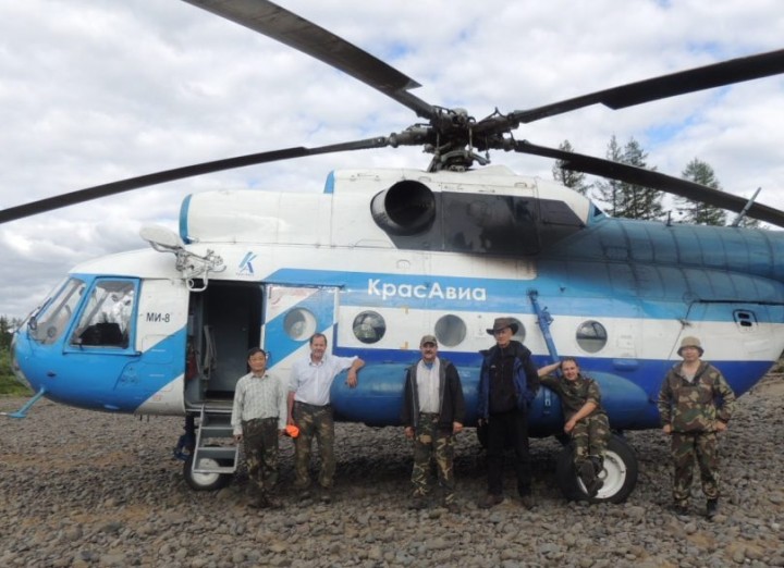
This morning we packed up and drove to the airport. We arrived early to talk to the company that rents helicopters. It turns out that they also have a big bi-plane available for rent. They use it for remote area deliveries for people and supplies, and for reconnaissance. It’s not at all like the little crop dusters one might think of when they hear bi-plane. It’s very big, and can carry a good sized load of people and gear.
It looks like we could have access to this plane next year, and it looks like it will be quite feasible to house and run the G-HLiT instrument from this plane. We’d like to find a Cessna, because that’s the plane that the instrument was designed to fly aboard. But this Anatov An-2 is a real possibility – and much better than a helicopter.
One major driver of this expedition is preparing for the flights of the G-LiHT Instrument over the next two years. G-LiHT stands for Goddard’s LiDAR, Hyperspectral, and Thermal airborne imager. It’s an instrument package that was put together by Bruce Cook at his team at NASA, and is designed to be a better tool to study forested ecosystems. It has two lidars, which are high resolution and can measure canopy crowns and gaps, and identify low growing vegetation. The hyperspectral and thermal instruments in the package can help characterize species, pick up photosynthetic pigments, and measure surface temperatures. The instrument package can even help determine environmental stressors, such as moisture content of the leaves, and help figure out whether we’re looking at a shrub or rocks – something we’re not getting from our space-based instruments. We think this is a great instrument package, and will give us really good data – but we need to locate an aircraft to fly it aboard, and we need fresh data from the field to help calibrate it in these larch forests.
The current lidar data we have available is ICESat 1 data. That stands for the Ice, Cloud, and land Elevation Satellite. The instrument on board, called GLAS (Geoscience Laser Altimeter System) was designed to measure ice, and clouds. The ICESat missions focus on ice and cloud, primarily. Vegetation can be measured, but it is a second thought for this program. ICESat 1 decommissioned from service in 2010. The replacement, ICESat 2, the next-generation satellite designed to look at ice and clouds in the polar regions, won’t be launched until 2016.
 The boreal region is important, and it’s changing. In order to
understand what is happing in this part of the world, we have to be able
to have instruments that can measure vegetation – the above ground
biomass, where a lot of carbon is stored. It’s just vital work, and it
can’t wait for ICESat 2. Because the need is so immediate, we can’t
create a new satellite fast enough. So Bruce and his team went to work
to pull together this extremely portable, very functional instrument
package. And we’re ready to get out and use it.
The boreal region is important, and it’s changing. In order to
understand what is happing in this part of the world, we have to be able
to have instruments that can measure vegetation – the above ground
biomass, where a lot of carbon is stored. It’s just vital work, and it
can’t wait for ICESat 2. Because the need is so immediate, we can’t
create a new satellite fast enough. So Bruce and his team went to work
to pull together this extremely portable, very functional instrument
package. And we’re ready to get out and use it.
But first, we had to get to the river. We had a little hitch at the airport. We drove into the Tura airport through the freight gate, because it was near the helicopter. Ross, Guoquing, Slava and I were all crammed into the van, with a huge pile of gear in the back. As icing on the cake, Slava’s shotgun was perched on top of the pile. The gate was guarded by a serious looking mature lady, in an impressive uniform. She nodded and asked Slava questions in Russian. He answers, and all seems well. Then she walked around the van and looked inside. I could tell when she saw the shotgun, because her pleasant look hardened and her head began shaking vigorously and firmly. No translation was needed – in any language, she was saying “no way are you going anywhere with that gun”.
We took a little diversion to a different building, where Slava chatted with officials and finally received clearance. The shotgun received a personal escort. It was hand carried to the helicopter by an unformed official. He personally loaded the gun onto the helicopter – I believe they put it forward with the pilots, because I didn’t see it again until we arrived on the river. Carrying a gun is a big deal here – it can be done, but they do make sure there’s not a chance that anyone will discharge it near the aircraft.
We had a good flight in. It was exciting to be flying over these remote forests again. After a two hour flight northward, the pilot set down on a rocky bar – our new home. We started unloading tents, clothes and sleeping bags – it’s just a huge pile of stuff. And it’s ours to care for and carry downriver for the next two weeks.
As soon as we landed, one of the helicopter crewmen hopped off the plane running, with a fishing rod in his hand. He ran to the river, tossed in his line, and started pulling out fish. Soon another crew member was downstream, fishing. The first caught six in just a few minutes; the other caught several as well. The moment our gear was out, however, they were back in the helicopter and then, within a few minutes, we were all alone on the river. They were good sports, though – they left us three fish. Three fish is a good start, but hardly enough for dinner for six scientists. So we went fishing too. Slava caught a seven pound pike, and I caught a pretty big fish, too. Soon we had enough for fish soup.
We’re camping on a big rocky bar, with trees all around. The river is beautiful. Fishing is good, too, but that’s not why we are here – we’re here to make measurements and collect data. The closest GLAS point is about 500 meters away. Tomorrow, we’ll break into two crews, and half of us will go northeast and half of us southwest and we’ll collect the measurements we can here tomorrow. There are a lot of GLAS footprints around – that’s the instrument on ICESat which provides us with the best available data to date on forest structure. We plan to measure heavily from this spot, and then move down river. I’ll be glad to get out and get measuring.
While we were just finishing up dinner, and trying to get the sat connection going – we found a serious glitch. The data terminal is not working. We checked it out in Maryland, and it was great. We have a strong signal, and everything looks like we should be fine. But it appears we have a problem with permissions of some sort. I’ve tried to reach the 24/7 support line of our provider, but had no luck. The crew back at home – my office staff and our writer, Joanne, will work on this today, and hopefully we can bring you photos soon.
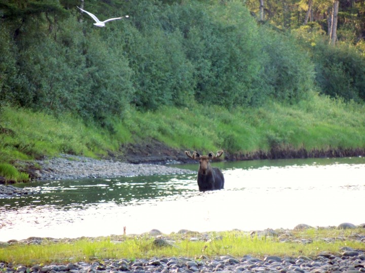 We’re seeing a lot of wildlife this trip, so far. There were lots of
birds in Tura. I’ve seen ravens, pigeons, European house sparrows,
arctic terns, gulls and a whole lot of things I couldn’t identify. One
of the birds in Tura was a small brown bird, with red on his tail. I
asked Slava to tell me the name of the bird, and he said something in
Russian – something I won’t ever remember. He said it translated to
“bird who has his tail in a fire”. Russian can be a very poetic and
descriptive language!
We’re seeing a lot of wildlife this trip, so far. There were lots of
birds in Tura. I’ve seen ravens, pigeons, European house sparrows,
arctic terns, gulls and a whole lot of things I couldn’t identify. One
of the birds in Tura was a small brown bird, with red on his tail. I
asked Slava to tell me the name of the bird, and he said something in
Russian – something I won’t ever remember. He said it translated to
“bird who has his tail in a fire”. Russian can be a very poetic and
descriptive language!
While we were in camp, a big bull moose came out of the forest about 200 yards upstream of us. We didn’t scare him at all – but he certainly took notice of us. He walked across the river very slowly, looking at us the whole time. Soon he crossed very slowly back again. He was magnificent, but he seemed to be challenging us a little. Like he was showing us the edges of his territory, and warning us to stay out of his space. If that’s the case, it’s unfortunate – because our first plots are right in that direction. In the morning, we’ll be heading straight for Papa Moose’s land.
It’s 9:20 p.m. here, and the sun is still up. I have a good 45 minutes before the sun sets behind the hill right in front of us. In Tura the sun went down at 11:30 p.m. and came up at 3:30 am, so that makes a 4 hour night. But the night is more of a dusky light, they say. Of course, I am asleep for those 4 hours, so I can’t testify personally to that.
Tonight, I can’t wait on the sun to slip below the horizon in order to go to sleep. I’ll be slipping into my sleeping back to try to get some much needed rest on the rocky ground. Tomorrow will be a long and physically strenuous day. I’m looking forward to it.
Writer’s note: After speaking with Jon, I worked with Jacob Gude, the Biospheric Lab’s secretary, and between the two of us we were able to contact the satellite phone provider. The service technician, Andy Cool, once we were able to reach him, provided prompt and diligent service. It turns out that there was a problem with permissions required by the Russian government – new requirements that had just been put into place. The company was able to solve the problem, and the data terminal now works. It is slow, and high resolution photos are too big to be sent from the field. But we do now have the ability to post photos from the field – and are quite grateful for the good stateside assistance.
Embenchime River 66 N 97 E
9:00 a.m. local, 9:00 p.m. EDT
65°F high 52°F low Sunny
It is a beautiful day on the Embenchime! The sun is shining, the skies are clear with just a few clouds scattered in the sky. We’re 282 miles in a straight line north of Tura. The river isn’t straight, however, so it’s more like 480 miles by boat. Earlier a brisk breeze blew the mosquitoes away, but not so much now. We pitched our tents on a dry, rocky bar along the river, and the local horde has come to greet us. Now I finally feel like I’m on an expedition!
The
scientific team at Tura airport, ready to head to the Embenchime. From
left to right: Guoqing Sun, Ross Nelson, Jon Ranson, Slava Kharuk,
Sergei Im and Pasha Oskorbin.
This morning we packed up and drove to the airport. We arrived early to talk to the company that rents helicopters. It turns out that they also have a big bi-plane available for rent. They use it for remote area deliveries for people and supplies, and for reconnaissance. It’s not at all like the little crop dusters one might think of when they hear bi-plane. It’s very big, and can carry a good sized load of people and gear.
It looks like we could have access to this plane next year, and it looks like it will be quite feasible to house and run the G-HLiT instrument from this plane. We’d like to find a Cessna, because that’s the plane that the instrument was designed to fly aboard. But this Anatov An-2 is a real possibility – and much better than a helicopter.
One major driver of this expedition is preparing for the flights of the G-LiHT Instrument over the next two years. G-LiHT stands for Goddard’s LiDAR, Hyperspectral, and Thermal airborne imager. It’s an instrument package that was put together by Bruce Cook at his team at NASA, and is designed to be a better tool to study forested ecosystems. It has two lidars, which are high resolution and can measure canopy crowns and gaps, and identify low growing vegetation. The hyperspectral and thermal instruments in the package can help characterize species, pick up photosynthetic pigments, and measure surface temperatures. The instrument package can even help determine environmental stressors, such as moisture content of the leaves, and help figure out whether we’re looking at a shrub or rocks – something we’re not getting from our space-based instruments. We think this is a great instrument package, and will give us really good data – but we need to locate an aircraft to fly it aboard, and we need fresh data from the field to help calibrate it in these larch forests.
The current lidar data we have available is ICESat 1 data. That stands for the Ice, Cloud, and land Elevation Satellite. The instrument on board, called GLAS (Geoscience Laser Altimeter System) was designed to measure ice, and clouds. The ICESat missions focus on ice and cloud, primarily. Vegetation can be measured, but it is a second thought for this program. ICESat 1 decommissioned from service in 2010. The replacement, ICESat 2, the next-generation satellite designed to look at ice and clouds in the polar regions, won’t be launched until 2016.
Nearing
the landing site, Ross Nelson (left) and Pasha Oskorbin (right)
excitedly anticipate arrival. Sergei Im (center) practices patience.
But first, we had to get to the river. We had a little hitch at the airport. We drove into the Tura airport through the freight gate, because it was near the helicopter. Ross, Guoquing, Slava and I were all crammed into the van, with a huge pile of gear in the back. As icing on the cake, Slava’s shotgun was perched on top of the pile. The gate was guarded by a serious looking mature lady, in an impressive uniform. She nodded and asked Slava questions in Russian. He answers, and all seems well. Then she walked around the van and looked inside. I could tell when she saw the shotgun, because her pleasant look hardened and her head began shaking vigorously and firmly. No translation was needed – in any language, she was saying “no way are you going anywhere with that gun”.
We took a little diversion to a different building, where Slava chatted with officials and finally received clearance. The shotgun received a personal escort. It was hand carried to the helicopter by an unformed official. He personally loaded the gun onto the helicopter – I believe they put it forward with the pilots, because I didn’t see it again until we arrived on the river. Carrying a gun is a big deal here – it can be done, but they do make sure there’s not a chance that anyone will discharge it near the aircraft.
We had a good flight in. It was exciting to be flying over these remote forests again. After a two hour flight northward, the pilot set down on a rocky bar – our new home. We started unloading tents, clothes and sleeping bags – it’s just a huge pile of stuff. And it’s ours to care for and carry downriver for the next two weeks.
As soon as we landed, one of the helicopter crewmen hopped off the plane running, with a fishing rod in his hand. He ran to the river, tossed in his line, and started pulling out fish. Soon another crew member was downstream, fishing. The first caught six in just a few minutes; the other caught several as well. The moment our gear was out, however, they were back in the helicopter and then, within a few minutes, we were all alone on the river. They were good sports, though – they left us three fish. Three fish is a good start, but hardly enough for dinner for six scientists. So we went fishing too. Slava caught a seven pound pike, and I caught a pretty big fish, too. Soon we had enough for fish soup.
We’re camping on a big rocky bar, with trees all around. The river is beautiful. Fishing is good, too, but that’s not why we are here – we’re here to make measurements and collect data. The closest GLAS point is about 500 meters away. Tomorrow, we’ll break into two crews, and half of us will go northeast and half of us southwest and we’ll collect the measurements we can here tomorrow. There are a lot of GLAS footprints around – that’s the instrument on ICESat which provides us with the best available data to date on forest structure. We plan to measure heavily from this spot, and then move down river. I’ll be glad to get out and get measuring.
While we were just finishing up dinner, and trying to get the sat connection going – we found a serious glitch. The data terminal is not working. We checked it out in Maryland, and it was great. We have a strong signal, and everything looks like we should be fine. But it appears we have a problem with permissions of some sort. I’ve tried to reach the 24/7 support line of our provider, but had no luck. The crew back at home – my office staff and our writer, Joanne, will work on this today, and hopefully we can bring you photos soon.
A
large bull moose crossed the river twice, about 200 m upstream from the
camp. He seemed to have a quietly challenging attitude, as if
patrolling his territory and firmly suggesting that the scientists stay
on their side of his line. The GLAS footprints lie in Papa Moose’s
territory, however; tomorrow the scientists will make measurements in
that forest. Hopefully the bull will be willing to share his lands.
While we were in camp, a big bull moose came out of the forest about 200 yards upstream of us. We didn’t scare him at all – but he certainly took notice of us. He walked across the river very slowly, looking at us the whole time. Soon he crossed very slowly back again. He was magnificent, but he seemed to be challenging us a little. Like he was showing us the edges of his territory, and warning us to stay out of his space. If that’s the case, it’s unfortunate – because our first plots are right in that direction. In the morning, we’ll be heading straight for Papa Moose’s land.
It’s 9:20 p.m. here, and the sun is still up. I have a good 45 minutes before the sun sets behind the hill right in front of us. In Tura the sun went down at 11:30 p.m. and came up at 3:30 am, so that makes a 4 hour night. But the night is more of a dusky light, they say. Of course, I am asleep for those 4 hours, so I can’t testify personally to that.
Tonight, I can’t wait on the sun to slip below the horizon in order to go to sleep. I’ll be slipping into my sleeping back to try to get some much needed rest on the rocky ground. Tomorrow will be a long and physically strenuous day. I’m looking forward to it.
Writer’s note: After speaking with Jon, I worked with Jacob Gude, the Biospheric Lab’s secretary, and between the two of us we were able to contact the satellite phone provider. The service technician, Andy Cool, once we were able to reach him, provided prompt and diligent service. It turns out that there was a problem with permissions required by the Russian government – new requirements that had just been put into place. The company was able to solve the problem, and the data terminal now works. It is slow, and high resolution photos are too big to be sent from the field. But we do now have the ability to post photos from the field – and are quite grateful for the good stateside assistance.
NASA: Siberi 2012: Progress along the Embenchime - Fighting the Embenchime - On the Banks of the Embenchime - Long Day in the Larch - From the Earth Observatory Blog
Ricardo M Marcenaro - Facebook
Operative blogs of The Solitary Dog:
solitary dog sculptor:
http://byricardomarcenaro.blogspot.com
Solitary Dog Sculptor I:
http://byricardomarcenaroi.blogspot.com
Para:
comunicarse conmigo,
enviar materiales para publicar,
propuestas:
marcenaroescultor@gmail.com
For:
contact me,
submit materials for publication,
proposals:
marcenaroescultor@gmail.com
Diario La Nación
Argentina
Cuenta Comentarista en el Foro:
Capiscum
My blogs are an open house to all cultures, religions and countries. Be a follower if you like it, with this action you are building a new culture of tolerance, open mind and heart for peace, love and human respect.
Thanks :)
Mis blogs son una casa abierta a todas las culturas, religiones y países. Se un seguidor si quieres, con esta acción usted está construyendo una nueva cultura de la tolerancia, la mente y el corazón abiertos para la paz, el amor y el respeto humano.
Gracias :)

Comments (0)
Publicar un comentario