
NASA: Mexico. Volcanic Plume from Popocatépetl - Russia. Fresh Lava on Tolbachik Volcano - 12.03.13
Posted by Ricardo Marcenaro | Posted in NASA: Mexico. Volcanic Plume from Popocatépetl - Russia. Fresh Lava on Tolbachik Volcano - 12.03.13 | Posted on 17:33
Volcanic Plume from Popocatépetl

acquired March 7, 2013
download large image (391 KB, JPEG, 1000x800)
acquired March 7, 2013
download GeoTIFF file (2 MB, TIFF)
Mexico’s Popocatépetl Volcano
released a plume in early March 2013. On March 8, Volcano Discovery
reported an ash plume reaching roughly 1,500 meters (4,900 feet) above
the volcano crater, or about 7 kilometers (4 miles) above sea level. On
March 6, the Ozone Monitoring Instrument (OMI) on NASA’s Aura satellite detected elevated levels of sulfur dioxide in the region, and the U.S. Air Force Weather Agency warned of potential ash and steam emissions the next day.
The Moderate Resolution Imaging Spectroradiometer (MODIS) on NASA’s Terra satellite captured this natural-color image of the plume from Popocatépetl on March 7, 2013. The plume blew eastward away from the volcanic summit. The northern edge of the plume was thick enough to hide the land surface from the satellite sensor’s view, as well as cast a shadow.
Located roughly 70 kilometers (45 miles) southeast of Mexico City, Popocatépetl is a stratovolcano composed of alternating layers of volcanic ash, lava, and rocks ejected by earlier eruptions. It reaches an altitude of 5,426 meters (17,802 feet) above sea level, and it is one of Mexico’s most active volcanoes. Historical records, including Aztec codices, record frequent eruptions from Popocatépetl.
References
- Global Volcanism Program Popocatépetl. Smithsonian Institution. Accessed March 11, 2013.
- Volcano Discovery (2013, March 9) Popocatépetl Volcano (Central Mexico) activity update. Accessed March 11, 2013.
NASA image courtesy Jeff Schmaltz, LANCE MODIS Rapid Response and Robert Simmon. Caption by Michon Scott.
- Instrument:
- Terra - MODIS
Fresh Lava on Tolbachik Volcano

acquired March 6, 2013
download large image (2 MB, JPEG, 2665x2665)
On November 27, 2012, almost 36 years
after its last eruption, Russia’s Tolbachik began erupting again.
Emerging from two fissures, the eruption produced ash explosions and
very fluid lava flows, according to reports from the Kamchatka Volcanic
Eruption Response Team (KVERT). Tolbachik remained restless in early
March 2013. A KVERT report issued March 10 described volcanic tremors
and a thermal anomaly in satellite imagery.
Fresh lava rested on the surface of Tolbachik when the Advanced Land Imager (ALI) on NASA’s Earth Observing-1 (EO-1) satellite captured this image, on March 6, 2013. The lava flow kept the same general configuration that it showed the previous month. Just north of the lava flow, a plume rose above the volcano surface.
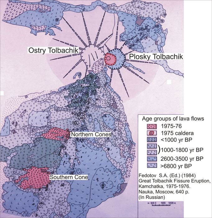
Tolbachik Volcano has a complicated configuration. The eastern half is a shield volcano—a low, broad structure resembling an ancient warrior shield—with nested summit calderas. The western half is a tall stratovolcano composed of alternating layers of ash, lava, and rocks from earlier eruptions.
Fresh lava rested on the surface of Tolbachik when the Advanced Land Imager (ALI) on NASA’s Earth Observing-1 (EO-1) satellite captured this image, on March 6, 2013. The lava flow kept the same general configuration that it showed the previous month. Just north of the lava flow, a plume rose above the volcano surface.
Tolbachik Volcano has a complicated configuration. The eastern half is a shield volcano—a low, broad structure resembling an ancient warrior shield—with nested summit calderas. The western half is a tall stratovolcano composed of alternating layers of ash, lava, and rocks from earlier eruptions.
References
- Global Volcanism Program Tolbachik Summary and Monthly Reports. Smithsonian Institution. Accessed March 12, 2013.
- Kamchatka Volcanic Eruption Response Team (2013, March 10) VONA/KVERT Daily Report Accessed March 12, 2013.
NASA Earth Observatory image created by Jesse Allen and Robert Simmon, using Advanced Land Imager data from the NASA EO-1 team. Caption by Michon Scott.
- Instrument:
- EO-1 - ALI
NASA: Mexico. Volcanic Plume from Popocatépetl - Russia. Fresh Lava on Tolbachik Volcano - 12.03.13

Comments (0)
Publicar un comentario